- All
- GIS
- research studies
- app development
- mapping
- security solutions
- smart city
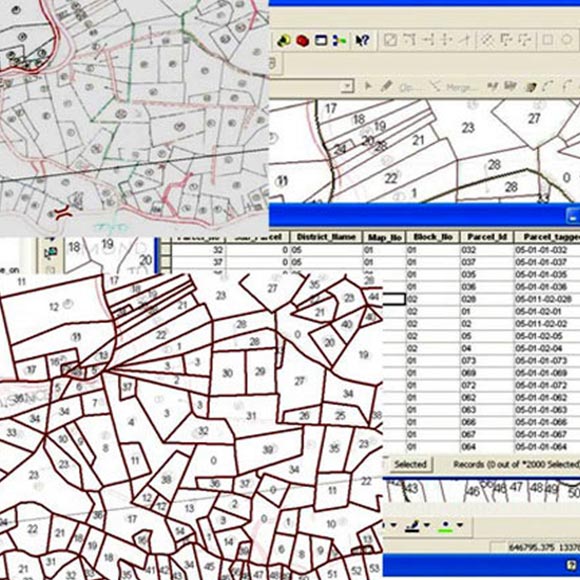
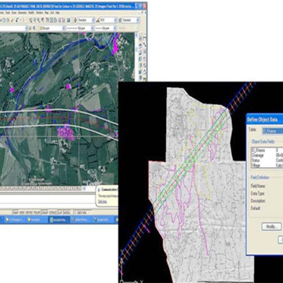
Digitization Of Cadestral Maps and Linkage with ROR
The project involves computerization of land record management processes where land data is managed and maintained on a Geographical Information System (GIS) based platform.
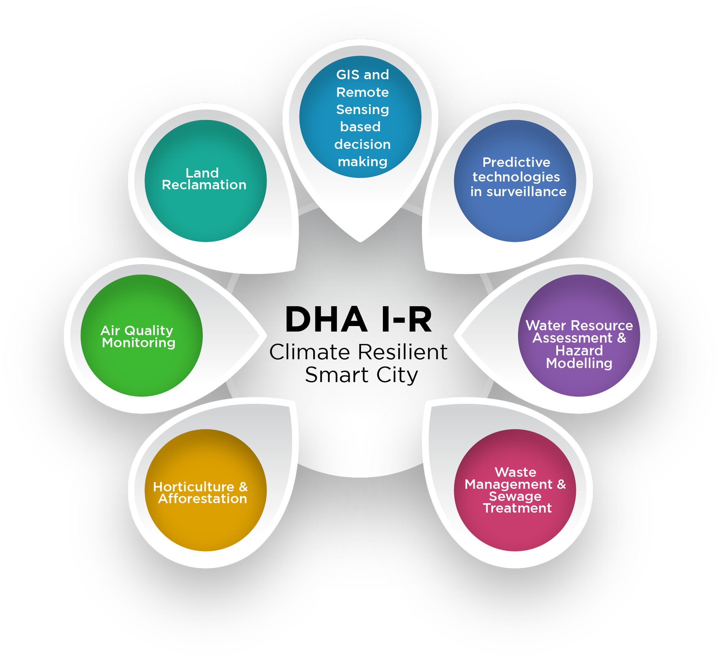
DHA I-R Smart City
GIS and Remote Sensing based assessments, analysis, and decision making in the varied fields like Land Reclamation, Predictive technologies in surveillance, Water Resource Assessment and Hazard Modelling, Waste Management and Sewage Treatment, Water Resource Assessment and Hazard Modelling, Horticulture and Afforestation & Air Quality Monitoring.
Karachi Division Land Bank GIS
The project involved the development of various GIS applications to support the innovate, and first of its kind, Land Bank of Pakistan that could help better lands planning and encourage feature and facilities based land lease. An important feature of the project was to integrate the GIS Spatial data with the computerized Land Records (LARMIS).

Consultancy for GIS based Land Record Digitization
R2V was awarded this Consultancy contract by the Board of Revenue, Baluchistan and involved in-depth studies, field research, business processes optimization and submission of (8) different reports encompassing all aspects of the proposed Land Record Digitisation for the province of Baluchistan.
City Layout
Complete city layout was created with sewerage piping shown in various colors and widths. All the manholes and their inserts were created.
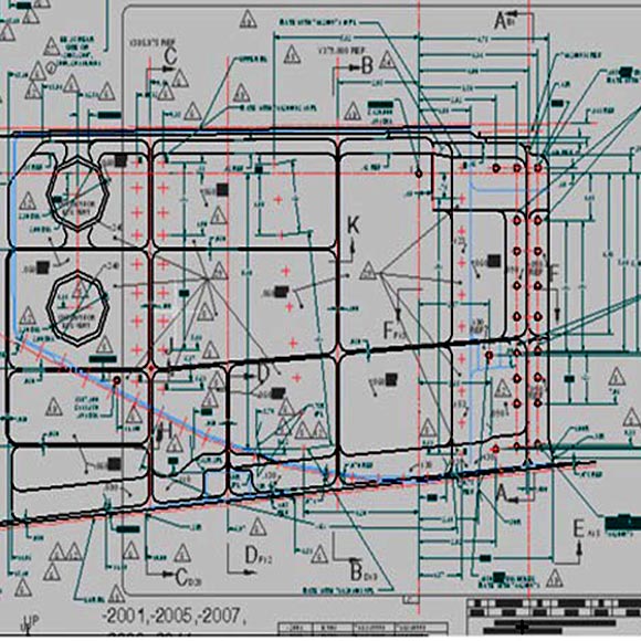
Architectural Layout and Modeling
3-D Models were generated to display the exterior finish and final outlook of a building with the help of floor plans and sketches. AIA Layering standards were maintained.
Gulf Stream Maintenance Programs
Schematics were produced illustrating method of assembly and disassembly of a part. These schematics were drawn in AutoCAD with the help of IsoPlanes to maintain accuracy.
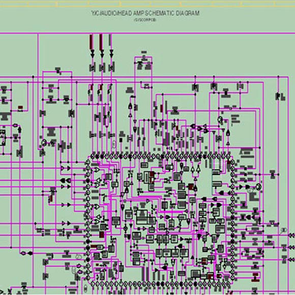
Circuit Board Design
he layout of PCB’s was regenerated in MicroStation j. Input was in the form of rough sketches and instruction from which complete PCB layouts were prepared in Microstation j. The links between instruments were kept dynamic and they change if any of the instruments are moved from one place to another.
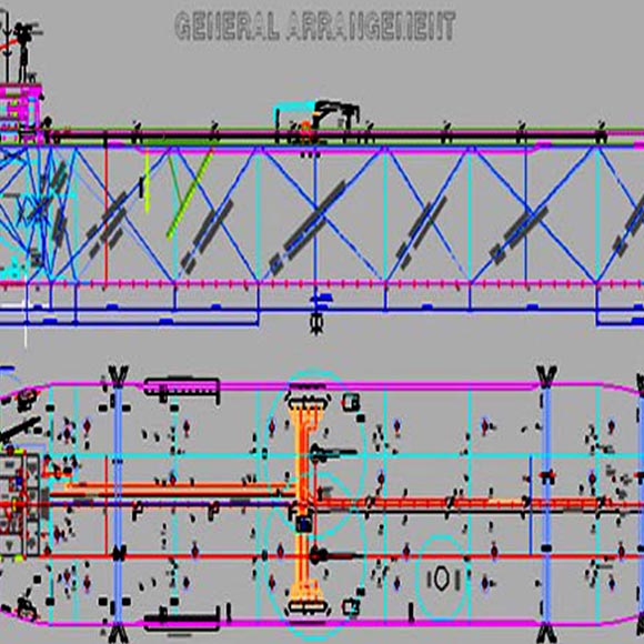
Fleet Operations
Old hand-made drawings of ship general arrangement was converted to editable digital format. Details of different decks were later on extracted and produced. Special printing layouts were created with multiple view ports to manage various objectives like showing the access or non access areas etc.
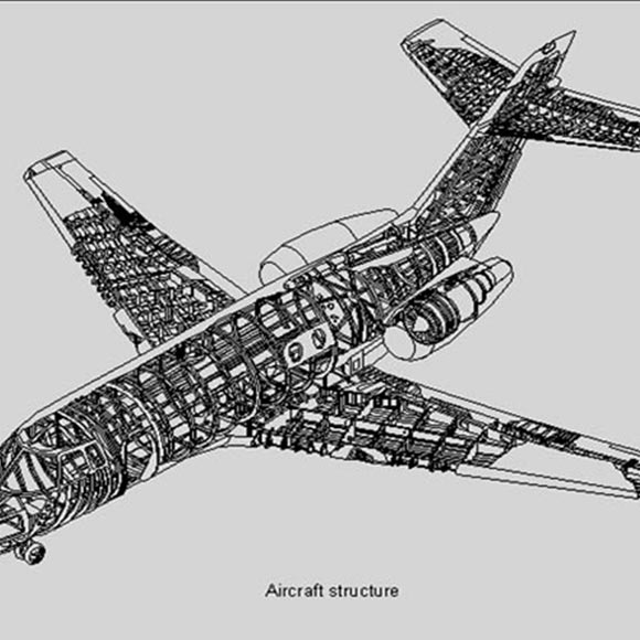
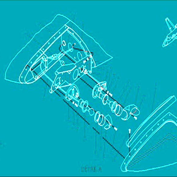
Aircraft Structure Details
Isometric drawings were generated using ISO planes in AutoCAD. These drawings range from the body of the aircraft to the interior settings of an aircraft like the detail of seats etc.
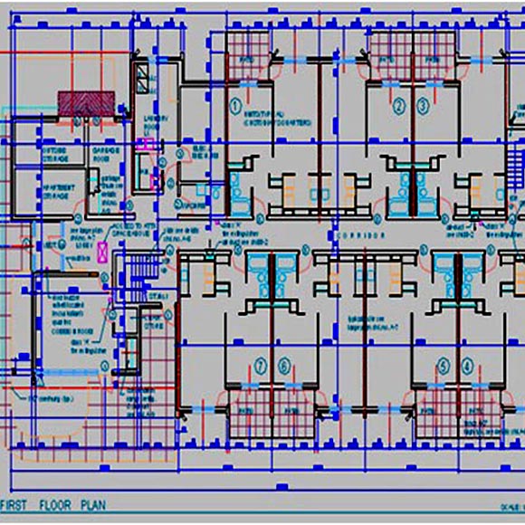
Architectural
Various multi-storey building hand-made drawings were provided to R2V (Private) Limited. An exact to the scale reproduction was required to calculate utilities such as piping ducting and electric cable required etc.
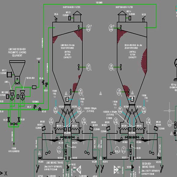
Process Flow Diagrams
AutoPLANT was used to generate and link all the process flow diagrams. These flow diagrams were created using an exact SNAP to locate objects. An external Microsoft Access database was also attached to the equipment.
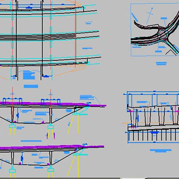
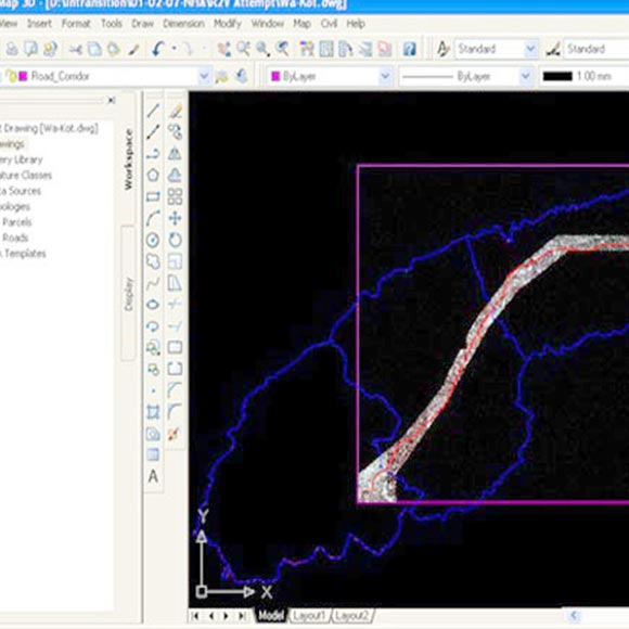
Bridge Drawings
Structural drawings of bridges on a highway were produced. The design and guidance were provided by the client in form of sketches and detailed drawings were created to fulfill the requirements. A strip map and plan & profile were also digitized from a basic survey data.
Aircraft Drawings
Scanned Mylars were provided to R2V Service by the client and vector conversion was required with high linear accuracy. These mylars were in the form of long rolls for development drawings of various aircraft parts. The required tolerance and machine symbol libraries were successfully created and implemented by R2V (Private) Limited.
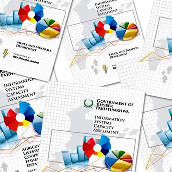
Information Systems Capacity Assessment
To affect immediate reform in various sectors of government departments, an assessment of the existing IT infrastructure and human resources was envisaged being a basic requirement by the KPK Government. R2V first set out to undertake a thorough field study. Personnel from all rungs of management were interviewed, physical infrastructure was assessed and tabulated.
GIS survey of the allotted lands
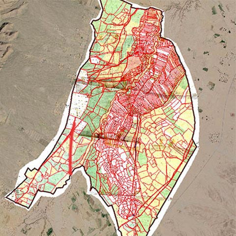
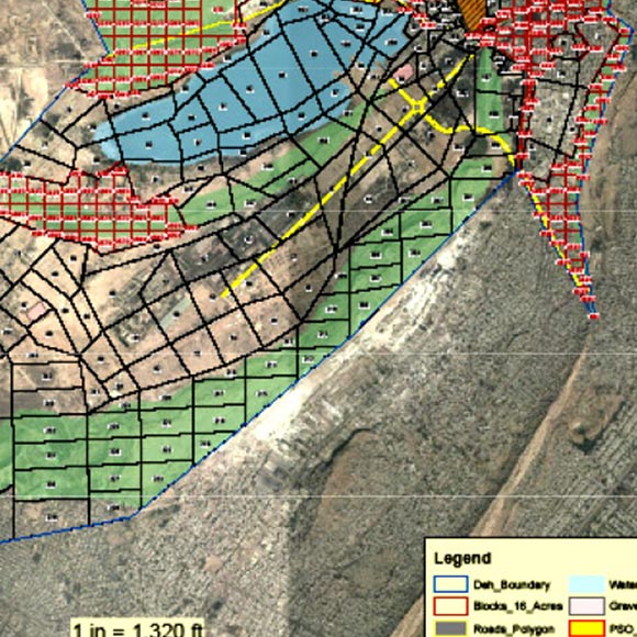
The Survey Department from Sindh Board of Revenue, under the mandate of the Supreme Court of Pakistan, tasked R2V to conduct a DGPS based GIS survey of the allotted lands of Karachi West District and to plot the available land into 16-acre plots. R2V conducted an intense field study, digitized the Land Record parcels (Deh maps), collaborated the parcels from Field Books dimensions, and geo-referenced the maps.
Data Entry of Land Records - Sindh
The Data Entry of Land Records - Sindh is launched by Government of Sindh, aimed to modernize management of land records, minimize the scope of land/property disputes, enhance transparency in the land records maintenance system, and facilitate moving eventually towards guaranteed conclusive titles to immovable properties in the province.
Facility Mapping
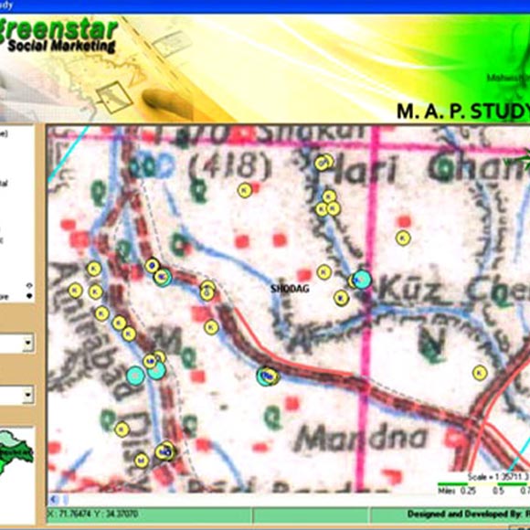
Lorem ipsum dolor sit The project involves field survey of Government and Private Hospitals, Family Healthcare Centres, Private Clinics, Drug Stores, Hakims and Homeopathic clinics. As the products offered by clients are mostly concerned with family planning, the places like General Stores and Cold Drinks shops were also mapped. A need-specific software application was also developed. .
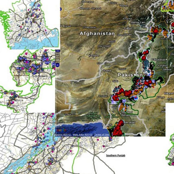
WASH study on the 32 flood affected districts of Pakistan
A comprehensive GIS was compiled through the field survey of all the flood-affected regions of Pakistan in the wake of 2010-2011 floods. This was a monumental task which comprised of deploying research staff throughout the country, identifying all the schools and health services that were affected and correlating the information.
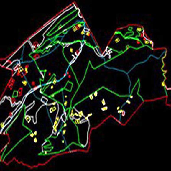
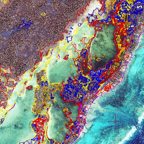
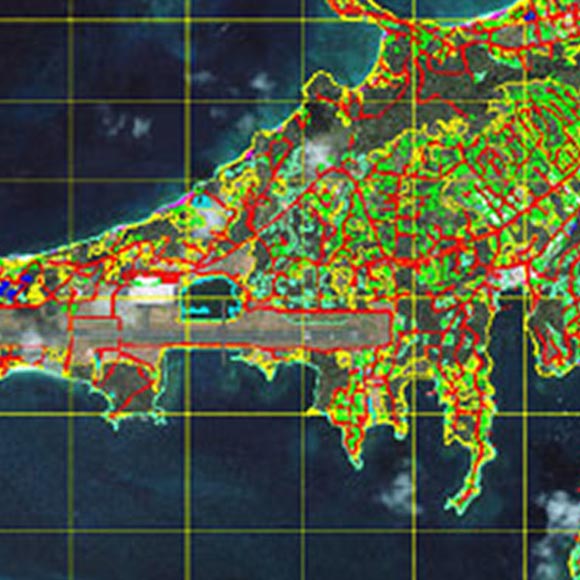
Feature extraction from satellite images and GIS Integration
High-resolution satellite images were acquired for identification of land-use and feature extraction and a GIS was prepared to feature all the required layers including the road network, water bodies, coastline, building footprints, plantation and various forms of land use. An additional layer of cadastral maps was integrated to identify the land ownership and parcel mapping.
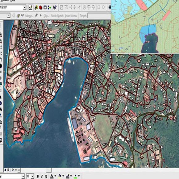
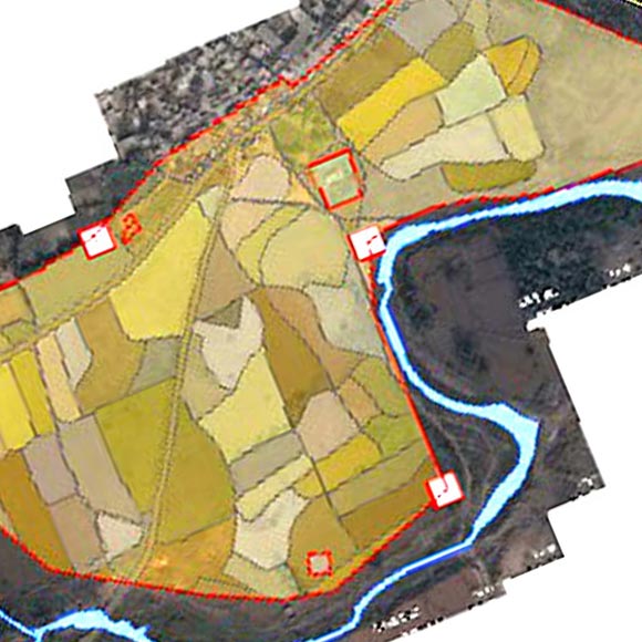
Cadastral Mapping and GIS Integration
Cadastral mapping was undertaken for land parcels of Grenada and the hand drafted output was sent to R2V head office for digitization and parcel identification tagging. The layer was then correlated with the feature extracted from high-resolution satellite images and a final output prepared as a comprehensive GIS.
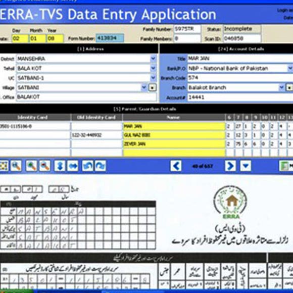
Targeted Vulnerability Survey
The project involves scanning of data entry of 425,000 forms filled during a fresh field survey to identify vulnerable people in the earthquake affected area. This huge task was amplified with a stringent deadline of 4 months and 100 percent quality assurance. Software application developed comprised of the following modules: Scanning module, Data Acquisition module, Rejection and Correction handling module.
Pilot Study on the Existing use of ROW and compilation of Inventory of Structures
This project was commissioned by the Chairman, NHA, as a proof of concept and contained the following salient features; Land Control Information be incorporated in an accurate manner The land records are integrated and the rights established in the corridor.
City Map of St. Lucia through Remotely Sensed data
Satellite images of different temporal resolution were analysed and a mosaic was created in ERDAS Imagine minimizing the effect of cloud cover. These rectified images were later on used for the preparation of settlement and Road network Layers to reflect the current situation. The attribute data was later on added to create a city map, which can be used for providing emergency services.
Survey of Affected Persons & Structures on Wazirabad-PindiBhattian section of NTC
National Highway Authority desired to prepare the Socio-Environmental impact assessment due to the proposed National Trade Corridor and commissioned the contracted study/survey as a prelude to the study. Identification of landowners, shareholders and tenants as per Land Revenue Record.
Digital Elevation Model of Trinidad
AutoCAD Map was used to create a DEM of Trinidad. The 1:50,000sheets were scanned, Geo-referenced and mosaiced to serve as a background map of the Island. All the contour lines were digitized in AutoCAD. The Elevation data was also attached to the AutoCAD environment. Finally, the ESRI GRID format was created based on elevation data from ArcGIS ArcView module.
GIS for the Earthquake Effected Areas
In the wake of the earthquake, R2V (Private) Limited volunteered to mobilize a panel of GIS experts to assist the Federal Relief Commission through the offices of DG C4I, General headquarters, Rawalpindi. The GIS tabulated various aspects of damage assessment and relief status along with the prediction of landslides, using Fuzzy Logic System.
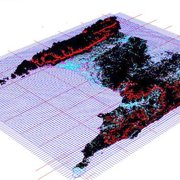
Land use Classification Of Belize
The high-resolution imagery was used for the delineation of the present coastal boundary of the island. Inventory of existing jetties was prepared with the database. Various spectral signatures were analyzed for the vegetation cover and finally, the image was classified for land use categories.
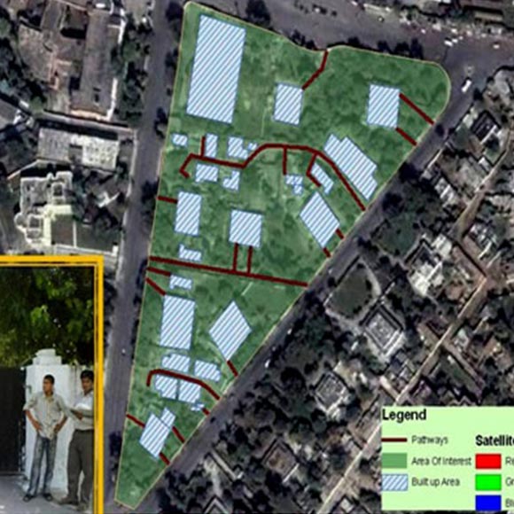
Identification of Extents and Encroachments on Military Camping Ground
The Director-General, MLC, commissioned this GIS study to ascertain the exact boundaries of their Camping Grounds using DGPS equipment, and in accordance with the Revenue Department records.
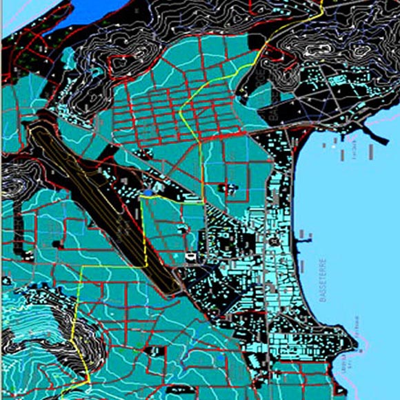
Topographic Mapping Of Saint Christopher
AutoCAD Map was used to create a GIS of Saint Christopher. All the topographic objects were modelled in AutoCAD and topologies were created for Road Networks for the calculation of shortest path. The data was attached also in AutoCAD environment to facilitate query wizard.
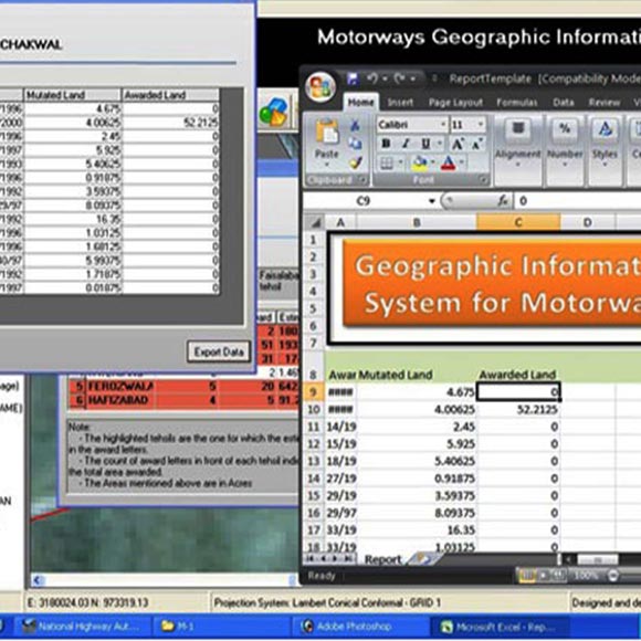
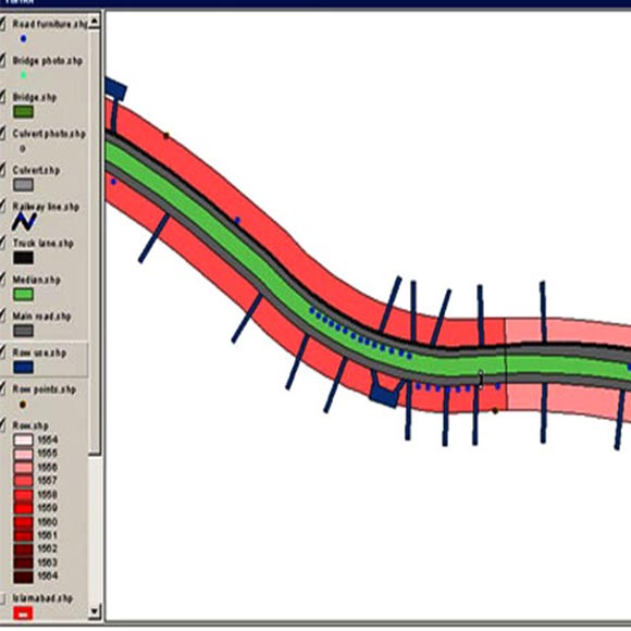
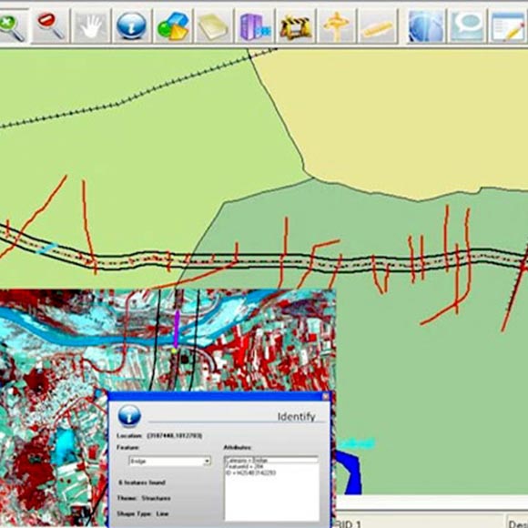
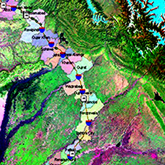
GIS for Pakistan Motorways, M1, M2 and M3
The first three sections of Pakistan motorways comprise of M1, M2, and M3. R2V was tasked to compile a detailed GIS of the three sections so that a reliable inventory of structures, road furniture, and roadside services could be tabulated. In addition, detailed land acquisition and settlement records were collected and tabulated within the GIS.
Socio-Economic Impact Assessment Data Collection for Proposed Motorway - M4
Under this GIS-based research study, R2V was involved in extensive fieldwork and data collection exercise ranging from each and every parcel of affected land, all the infrastructures, houses, facilities, plantation etc.
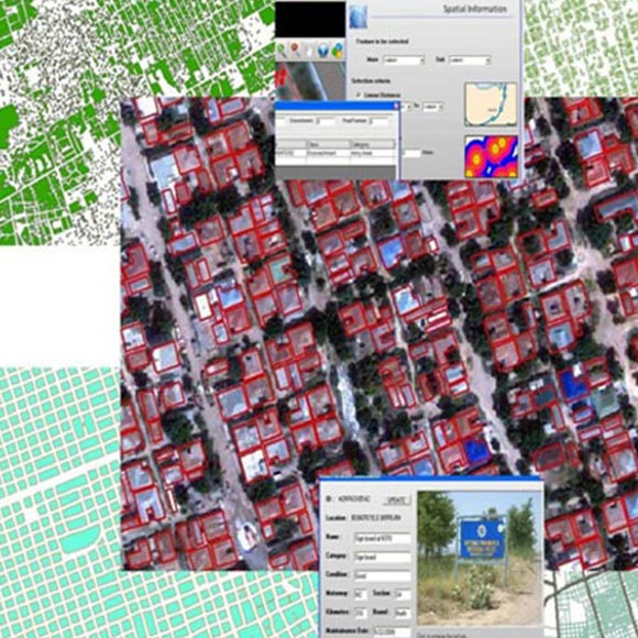
Facilities Mapping GIS at the scale of 1:5,000
This was again a very comprehensive GIS that involved the acquisition of 0.6m satellite images for the AOI, geo-referencing, and ortho-rectification of the images and the capturing all the visible features. Attribute information on the digitized data was acquired and tagged into their respective tables.
Baseline Survey Data for Socio-Economic Impact Assessment of Expressway –E 35
Under the vision of a National Trade Corridor, Expressway E-35 is an important component that would facilitate high-speed traffic to and from China. As a prelude to the Environmental and Social Impact. Assessment, this GIS-based research study involved extensive fieldwork and data collection exercise.
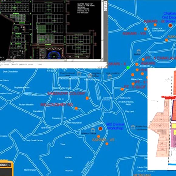
Housing Scheme Layout GIS
Army Housing Directorate builds and allots constructed housing units to the retired Army Officers. R2V was provided hand-drawn layout and building plans and asked to compile a detailed GIS on each scheme, overlay these over 0.6m Satellite Images against each location and to digitize and display the floor plans of various units under each scheme.
Land Evaluation Information
akistan Railways has massive landholding throughout Pakistan in shape of their right of Way. However, most of the land was underutilized, encroached upon or ill-defined. R2V was engaged to build upon the concept, floated by R2V.
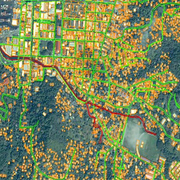
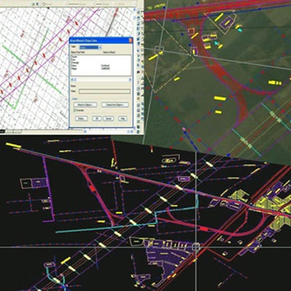
Defining Right of Way for National Highway
DGPS based mapping of the N5 road corridor (both the North and South bounds) was performed to ascertain the area that falls under its Right of Way between Peshawar and Okara. Kinematic leap frog survey technique was employed to demarcate the existing road up to Centimetre accuracy. Attribute data was designed and implemented in ArcGIS environment for value and area of land.
Grenada Crisis GIS
IKONOUS 1m resolution satellite imagery was used in conjunction with 1:2,500 topo-sheets for the creation of an up-to-date map of Grenade and a Digital Elevation Model to assist the relief activities. The topographic maps were geo-referenced, digitized and a mosaic was created. This Mosaic was later on updated with the Ikonous satellite imagery.
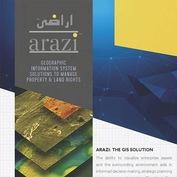
Arazi
This is a Core GIS Management System specifically large, planned settlements and it enables integrated planning, development, operations and resource management along with informed decision making.
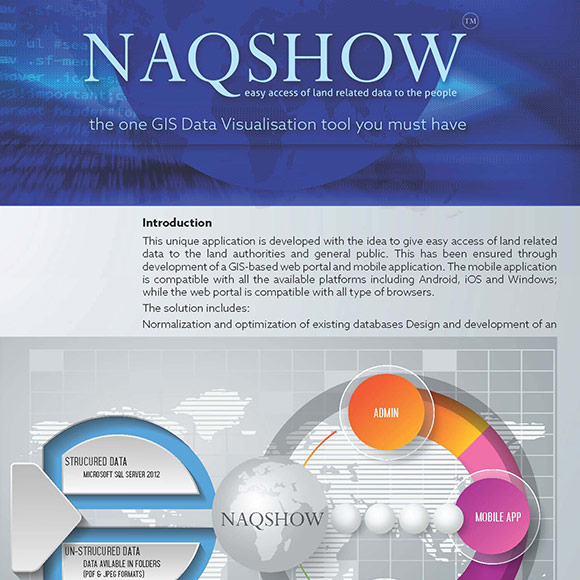
Naqshow
Naqshow is a GIS-based web application for accessing the online land records.